
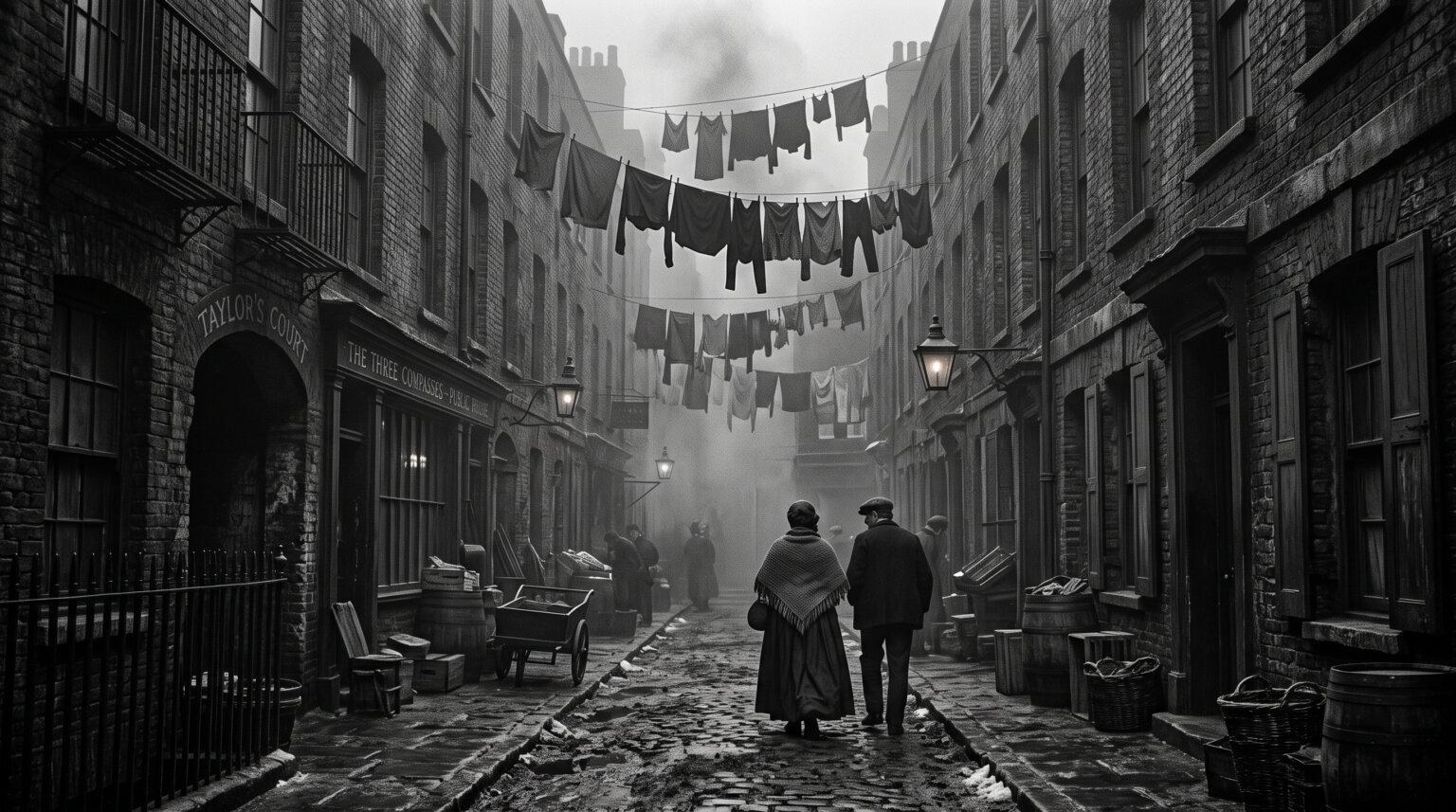
Walk down Old Compton Street today and you will find cocktail bars, independent theatres, and restaurants serving food from a dozen countries. Two centuries ago, the very same ground was home to some of the most notorious slum districts in Victorian London. The forgotten slums Soho London history has largely buried were a tangled warren of overcrowded tenements, open sewers, and courtyard dwellings that housed thousands of the city’s poorest residents.
Most people associate Victorian slums with the East End. Whitechapel, Bethnal Green, and the Old Nichol dominate the popular imagination, helped along by Dickens and Ripper lore. Yet Soho, sitting squarely in the fashionable West End, harboured slums that were every bit as grim. The difference is that Soho’s poverty was tucked away behind the grand facades of Regent Street and Oxford Street, making it easier to forget.
In this article, I want to dig beneath the pavement of modern Soho and recover the streets, the people, and the conditions that defined this district before clearance and redevelopment scrubbed them from view. We will trace the boundaries of the slum quarter, examine what life was like inside it, and visit the few physical remnants that survive today, including the famous Little Compton Street signs hidden beneath a grate on Charing Cross Road.
Understanding Soho’s slum past matters because it explains how this neighbourhood became what it is. The cheap rents that followed clearance attracted waves of immigrants, artists, and outsiders who shaped Soho’s bohemian identity. The modern cultural district was built, quite literally, on the foundations of a demolished slum.
Table of Contents
What Were the Slums of Soho? Defining the Forgotten Slums Soho London History Forgot
Soho’s slums were a dense concentration of substandard, overcrowded housing that occupied the area bounded roughly by Oxford Street to the north, Charing Cross Road to the east, Shaftesbury Avenue to the south, and Regent Street to the west. Within this footprint, narrow courts, alleyways, and back-to-back houses formed what Victorians called a rookery, a term for a crowded, ramshackle settlement named after the communal nesting habits of rooks.
A rookery was the Victorian equivalent of a modern informal settlement. Buildings were repeatedly subdivided into smaller and smaller rooms, each packed with tenants. Landlords maximized rental income by carving up existing structures, adding makeshift partitions, and converting cellars and attics into living space. The result was a maze of windowless rooms, shared courtyards, and passages so narrow that two people could barely pass.
Soho’s slums developed as the West End expanded around them. When aristocratic landowners began laying out grand squares and wide streets in the 17th and 18th centuries, the cheaper land in between was left to speculative builders who threw up cheap housing for workers and migrants. Over decades, this housing deteriorated, and as wealthier residents moved to newer developments, the poorest were left behind in crumbling properties with no maintenance.
By the mid-19th century, these forgotten slums had become a parallel world existing within walking distance of Mayfair mansions and Buckingham Palace. Social investigators who ventured inside described scenes of deprivation that rivalled anything in the East End. Yet because Soho’s slums were geographically small and hidden behind main roads, they attracted far less public attention than the sprawling rookeries of Whitechapel or Bermondsey.
The Streets That Formed Soho’s Slum District
The street pattern of slum-era Soho was fundamentally different from the grid a visitor sees today. Several major thoroughfares that now define the neighbourhood, most notably Charing Cross Road and Shaftesbury Avenue, did not exist until the late 19th century. They were driven directly through the slum quarters as part of clearance schemes.
Little Compton Street was one of the most significant streets lost to demolition. It ran east from what is now Old Compton Street, connecting the Soho district to the St Giles area. In 1886, the Metropolitan Board of Works obliterated Little Compton Street to make way for the construction of Charing Cross Road, which opened the following year. The street vanished from the surface entirely, though its name survives on Victorian street signs still visible through a pavement grate at the corner of Charing Cross Road and Old Compton Street.
Old Compton Street itself, now the vibrant heart of modern Soho, was once lined with cheap lodging houses and tenement dwellings. Soho Street, Pulteney Court, Bean Street, and dozens of smaller alleyways formed a tight lattice of poverty. Many of these side streets were so narrow that daylight barely reached ground level, and cart access was impossible, meaning refuse and nightsoil accumulated unchecked.
Regent Street played a particularly important role in Soho’s social geography. When John Nash designed and built Regent Street between 1812 and 1825, it functioned as a deliberate physical barrier separating the fashionable West End from the slum districts to its east. Nash’s grand colonnaded boulevard was, in effect, a wall of respectability erected to screen the gentry from the squalor that lay behind it.
Academic research using space syntax analysis has shown that the small block sizes and fragmented street pattern of slum-era Soho were themselves a factor in concentrating poverty. The area’s dense, poorly connected street network isolated residents from the wider city economy, trapping them in a self-reinforcing cycle of deprivation that the wider main roads did nothing to penetrate.
Inside the Slums: Living Conditions in Victorian Soho
Living conditions inside Soho’s slums were defined by three relentless facts: overcrowding, filth, and disease. Housing that had been built for single families in the 17th century was, by the Victorian era, housing a dozen or more people per building. Rooms were sublet by the night to lodgers who shared beds in shifts, a system common in the doss houses that dotted the area.
Sanitation was virtually non-existent. Before the construction of London’s modern sewer network in the 1860s, human waste accumulated in cesspits beneath houses or was dumped into open drains that ran down the middle of streets. Water came from pumps drawing from contaminated wells, and the famous Broad Street cholera outbreak of 1854, traced by Dr John Snow to a single pump in Soho, demonstrated the deadly consequences.
Disease was a constant companion. Cholera, typhus, typhoid, and tuberculosis all thrived in the damp, overcrowded conditions. Infant mortality was staggeringly high, and life expectancy in the worst streets was decades below the London average. The stench of the neighbourhood was noted by numerous social investigators, who described the air as thick with the smell of decomposing refuse and unwashed bodies.
Buildings themselves were structurally unsound. Many houses had been subdivided so many times that load-bearing walls had been cut through, floors sagged, and roofs leaked. Collapse was not uncommon. Fire was an ever-present danger, given the combination of timber construction, open hearths, and candle lighting. When fire broke out in a slum court, it could consume an entire block before any assistance arrived.
Who Lived in Soho’s Slums? The People Behind the Forgotten Slums Soho London History
The residents of Soho’s slums were a remarkably diverse population. Far from being a homogeneous mass of the destitute, the area was home to working families, skilled artisans, recent immigrants, and the genuinely destitute, all packed together in a few cramped streets. Recovering their individual stories is one of the most important gaps in the existing literature on the area.
The Italian immigrant community was one of the most distinctive groups in Victorian Soho. From the 1840s onwards, Italian migrants, many from the mountain communities around Parma and Lucca, settled in the district in large numbers. They worked primarily as street musicians, organ grinders, and sellers of penny ices, the forerunners of the modern ice cream trade. By the 1880s, the area around Little Compton Street and Old Compton Street was known as London’s Little Italy.
Other immigrant groups included French Huguenots, who had arrived earlier and established themselves in the silk and watchmaking trades, Irish labourers who came during and after the Famine, and a substantial Jewish community involved in tailoring and secondhand goods. Soho’s slums were, in many ways, a classic immigrant reception area, the first stop for newcomers who arrived with few resources and needed cheap accommodation near casual work.
The occupations of residents tell their own story about the Victorian economy. Street sellers, costermongers, laundry women, casual dockers, and domestic servants on their days off all filled the lodging houses. Many worked in the service economy of the surrounding West End, cleaning the homes and serving the meals of the wealthy who lived minutes away. The irony that some of London’s poorest people served its richest was not lost on contemporary commentators.
Charles Booth’s Poverty Maps: Soho in Red and Black
No document captures the reality of late Victorian poverty more vividly than Charles Booth’s poverty maps. Booth, a shipping magnate turned social researcher, set out in the 1880s to produce a systematic, evidence-based survey of London life. His team walked every street in the capital, recording the social condition of residents and assigning each street a colour code based on household income and moral character as assessed by school board visitors and police.
The colour coding ran from black, for the lowest class of occasional labourers and the destitute, through dark blue, light blue, and purple, up to red and yellow for the comfortable middle and upper classes. When you look at Booth’s 1889 map of Soho, the area is a patchwork of black, blue, and purple, with only the main arterial roads showing the red that denoted respectable working-class streets. The contrast with neighbouring Mayfair, which glows solid red and yellow, is stark.
What makes Booth’s work so valuable for understanding the forgotten slums Soho London history has neglected is the level of detail. His researchers did not just classify streets; they wrote notebooks full of observations about individual buildings, residents, and local characters. These notebooks, now digitised and available through the London School of Economics, allow researchers to reconstruct the social fabric of Soho’s slums street by street, building by building.
Booth’s maps also reveal the spatial logic of poverty in the area. The poorest streets, marked black and dark blue, cluster in the interior of the block, away from the main roads. The more respectable purple streets line the thoroughfares where trade and foot traffic brought some economic life. This pattern confirms the space syntax analysis: it was the hidden, disconnected interior streets that trapped the deepest poverty.
Why Did Soho Have Slums? Economic and Social Causes
The existence of slums in the heart of the fashionable West End seems paradoxical, but it followed a clear economic logic. Land in Soho was owned by a small number of aristocratic estates, including the Portland, Berners, and ground landlords who held long leases. Rather than redeveloping decaying properties, these landlords found it more profitable to subdivide and lease them to middlemen, who in turn sublet to sub-landlords, who sublet again to tenants.
This chain of subletting, which contemporaries called the house-scaffolding system, meant that no single party had an incentive to maintain the properties. Rents were collected at each level, with every middleman taking a cut, leaving nothing for repairs. The tenants at the bottom of the chain paid the most per room but received the worst accommodation. This structure was the engine that drove the deterioration of Soho’s housing stock.
The second factor was demand. Soho’s location, adjacent to the West End’s commercial and domestic service economy, created a constant inflow of workers who needed to live near their employment. Casual labourers could not afford the time or cost of commuting from cheaper districts on the city fringe. The resulting competition for rooms drove up rents and densities, pushing more and more people into ever-smaller spaces.
The third factor was regulatory failure. Before the passing of the Artisans’ and Labourers’ Dwellings Improvement Act in 1875, there was no effective legal mechanism for clearing or improving slum housing. Local vestries had limited powers and less inclination to act. Even after reforming legislation passed Parliament, enforcement in the West End lagged behind the East End, where the scale of poverty made intervention politically unavoidable.
Soho vs the East End: How the Slums Compared
It is natural to ask how Soho’s slums compared to the famous East End rookeries. The short answer is that they were smaller in scale but comparable in intensity. While the Old Nichol in Bethnal Green housed around 5,700 people in roughly thirty streets by the 1880s, Soho’s slum quarter was more compact, occupying a handful of blocks. But the conditions within individual buildings were broadly similar.
The demographic makeup differed significantly. The East End slums were dominated by English-born casual labourers and Irish immigrants, with a growing Jewish community in Spitalfields. Soho’s slums, by contrast, were far more internationally mixed, with Italians, French, Germans, and Eastern European Jews all represented. This cosmopolitan character gave Soho a distinct atmosphere that contemporary writers frequently noted.
The most important difference was visibility. The East End slums were notorious precisely because they were distant from the centres of wealth and power, allowing a comfortable othering in the press and literature. Soho’s slums, sitting cheek by jowl with gentlemen’s clubs and fashionable shops, were an embarrassment that polite society preferred not to acknowledge. This geography of denial is a key reason the forgotten slums Soho London history documents remain underexplored.
The consequence of this difference is still felt today. The Old Nichol is memorialised in Arthur Morrison’s novel A Child of the Jago, in Sarah Wise’s historical study The Blackest Streets, and in the Boundary Estate that replaced it, the world’s first council housing. Soho’s slums, by contrast, have no equivalent literary monument. Their clearance was quieter, their memory more thoroughly erased.
The Clearance: How Soho’s Slums Were Demolished
The demolition of Soho’s slums was a piecemeal process that unfolded over several decades rather than a single dramatic event. The Metropolitan Board of Works, the body responsible for London’s infrastructure from 1855 until its abolition in 1889, was the primary agent of clearance. Its most significant intervention in Soho was the construction of Charing Cross Road, authorised in 1877 and completed in 1887.
Driving Charing Cross Road through the slum quarter required the obliteration of Little Compton Street and numerous smaller courts and alleys. The scheme was justified on the grounds of improving traffic flow between Oxford Street and Trafalgar Square, but it also served the purpose of breaking up a notorious slum district. The road was opened with considerable ceremony by the Duke of Cambridge in 1887.
Shaftesbury Avenue, constructed between 1877 and 1886, was a similar exercise in slum clearance dressed up as transport improvement. Together, these two new thoroughfares sliced through the heart of Soho’s poorest quarter, demolishing hundreds of dwellings and displacing thousands of residents. Regent Street, built decades earlier, had already served as a template for using road construction as a tool of social engineering.
What happened to the people who lived there is one of the most troubling aspects of slum clearance. Displaced residents were rarely rehoused in the new developments that replaced their homes. Most simply moved to other cheap districts, transferring the problem rather than solving it. Forum discussions and family histories preserved on sites like Reddit reveal that descendants of displaced Soho families often lost all connection to the area, their ancestors’ presence erased as completely as the buildings themselves.
Literary and Artistic Connections to Soho’s Slum Past
Soho’s slums attracted the attention of writers and artists, though less intensively than the East End. William Blake, who lived in Soho’s Broad Street (now Broadwick Street) from 1757, grew up surrounded by the district’s poverty. His visions of London as a city of dark satanic mills and chained chimney sweeps drew directly on the world he saw outside his door.
Charles Dickens knew Soho intimately and set portions of several novels in the district. The lodgings of characters in A Tale of Two Cities and Bleak House draw on the Soho he walked through as a reporter and social observer. Dickens’s journalism, particularly his sketches for Household Words, documents the conditions of London’s hidden poor with a specificity that remains valuable to historians today.
The photographer John Thomson and the journalist Adolphe Smith produced Street Life in London in 1877, a pioneering work of documentary photography that included images of Soho’s street sellers, Italian ice-men, and doss-house residents. Their work provides some of the only photographic evidence of daily life in the slum quarter, capturing faces and scenes that the written record alone cannot convey.
Gustave Dore’s engravings of London poverty, published in London: A Pilgrimage in 1872, though focused more on the East End, shaped the visual vocabulary through which Victorians understood urban squalor. Soho’s slums existed in the shadow of these more famous images, contributing to the district’s relative anonymity in the literature of Victorian poverty.
What Remains Today: Traces of Soho’s Slum History You Can Still See
Very little physical evidence of Soho’s slum past survives above ground. The clearance programmes of the late 19th century, followed by further redevelopment throughout the 20th century, removed almost every building associated with the rookeries. But a handful of traces remain for those who know where to look.
The most famous survivor is the Little Compton Street signs visible through a pavement grate at the junction of Charing Cross Road and Old Compton Street. Two faded enamel signs, painted on the wall of what appears to be an underground chamber, bear the street name that was erased from the surface in 1886. This fragment has become a pilgrimage site for enthusiasts of hidden London.
The truth about these signs is slightly more prosaic than the legend suggests. Little Compton Street was not buried intact beneath the new road. What the grate reveals is a utility tunnel, part of the service infrastructure built beneath Charing Cross Road, in which the old street signs were preserved or possibly relocated during construction. The effect is no less evocative for the explanation: you are looking at a fragment of a street that no longer exists, preserved in the subterranean guts of the city that replaced it.
To visit the signs, head to the pedestrian island at the corner of Charing Cross Road and Old Compton Street. Look down through the metal grille set into the pavement. The signs are on the wall below, sometimes easier to see at night when a torch can be angled through the bars. Please be aware of traffic, as this is a busy junction.
Other traces are subtler. The street pattern of inner Soho, with its small blocks and narrow side streets, still reflects the footprint of the original rookeries, even though every building has been replaced. A few surviving 18th-century houses on the edge of the district hint at what the rest once looked like. And the very fact that Soho remains a district of small businesses, cheap eats, and transient populations echoes the social character established in its slum years.
Timeline: Soho’s Journey from Slum to Cultural District
The transformation of Soho from open fields to slum district to cultural quarter unfolded over more than three centuries. The key dates below trace that journey:
1536: The area that would become Soho is recorded as open hunting ground, giving the district its name from a hunting cry.
1670s-1690s: Speculative builders construct the first housing in Soho Square and surrounding streets, intended for the gentry.
1720s-1750s: Wealthier residents begin moving west to newer developments. Properties in Soho start subdividing as poorer tenants move in.
1812-1825: John Nash builds Regent Street, creating a physical barrier between fashionable West End and the emerging slum district to the east.
1840s-1850s: Italian immigrants arrive in large numbers, establishing Little Italy around Old Compton Street and Little Compton Street.
1854: Dr John Snow traces a deadly cholera outbreak to the Broad Street pump in Soho, proving the waterborne transmission of the disease.
1877: Construction of Shaftesbury Road begins, cutting through Soho’s slum quarter.
1886-1887: Little Compton Street is demolished. Charing Cross Road opens, further fragmenting the slum district.
1889-1903: Charles Booth publishes his poverty maps and survey, documenting conditions in Soho’s remaining poor streets.
1930s-1960s: Remaining slum housing cleared. Soho begins its transformation into a centre of nightlife, restaurants, and the creative industries.
2026: Soho is one of London’s most expensive and culturally significant districts, its slum past visible only in street patterns, hidden signs, and archives.
FAQs
What is the famous street in Soho, London?
Old Compton Street is the most famous street in Soho, known today for its LGBTQ+ venues, restaurants, and vibrant nightlife. In the 19th century it was the heart of Soho’s slum district and the centre of London’s Little Italy immigrant community, lined with tenement housing and doss houses rather than cocktail bars.
What were the slums in London in the 1800s?
The slums of Victorian London were overcrowded, unsanitary districts of subdivided housing where the city’s poorest residents lived. Known as rookeries, they were characterised by extreme density, open sewers, contaminated water, and high rates of disease. Major slum districts included the Old Nichol in Bethnal Green, Jacob’s Island in Bermondsey, St Giles Rookery, Devil’s Acre in Westminster, and the slum quarter of Soho between Regent Street and Charing Cross Road.
Which was described as the worst street in London?
Dorset Street in Spitalfields was famously described as the worst street in London, earning the nickname Murder Alley for its extreme violence and deprivation. Within Soho specifically, Little Compton Street and the surrounding courts were considered among the most notorious slum streets in the West End before their demolition in 1886.
Are there any Victorian slums left in London today?
Almost no buildings from London’s Victorian slums survive. Nearly all were demolished during clearance programmes that continued through the 1960s. A handful of individual structures remain in scattered locations, but in Soho specifically, no slum-era buildings are left standing. The only physical remnants are the Little Compton Street signs preserved in a utility tunnel beneath Charing Cross Road.
What happened to the residents when Soho’s slums were demolished?
When Soho’s slums were cleared for road construction and redevelopment, most displaced residents were not rehoused on site. They moved to other cheap districts in London, spreading the problem rather than solving it. Many families lost all connection to the area, and descendants today often only discover their Soho roots through genealogical research and census records.
Where can I still see traces of Soho’s slum past?
The most visible trace is the Little Compton Street signs seen through a pavement grate at the corner of Charing Cross Road and Old Compton Street. Other traces include the small block sizes and narrow side streets of inner Soho, which preserve the footprint of the original rookery, and Charles Booth’s poverty maps and notebooks, which are freely available online through the London School of Economics.
Why were Soho’s slums less famous than the East End slums?
Soho’s slums were less famous because they were smaller in scale and hidden behind the fashionable West End. The East End slums, being geographically distant from centres of wealth and power, were easier to portray as a separate world of otherness. Soho’s poverty, sitting adjacent to Mayfair gentlemen’s clubs and fashionable shops, was an embarrassment that polite society preferred to overlook and that writers found less dramatic to describe.
How accurate are literary portrayals of London slums?
Literary portrayals by writers like Charles Dickens and Arthur Morrison were based on direct observation and are broadly accurate in their depiction of conditions, though they inevitably emphasised the most dramatic and sensational aspects for narrative effect. Modern historians cross-reference these works with census returns, Charles Booth’s social surveys, and photographic evidence to build a more complete and nuanced picture of slum life.
Conclusion: Remembering What the Pavement Covers
The forgotten slums Soho London history has buried are a reminder that the most fashionable districts of any great city often have a hidden past built on poverty and displacement. Soho’s cocktail bars and restaurants stand on ground that once housed some of Victorian London’s most desperate residents, in streets that no longer exist, in buildings that were demolished without ceremony.
Recovering this history matters for several reasons. It honours the people who lived and died in these streets, whose names and stories have been almost entirely erased. It explains how Soho became the cosmopolitan, bohemian district we know today, since the cheap rents that followed clearance attracted the immigrant communities and creative outsiders who shaped its modern identity. And it warns us that the process of clearance and gentrification, far from being a story of progress, often involved the simple displacement of poverty to less visible locations.
For those who want to explore further, the Charles Booth archive at the London School of Economics offers a street-level record of Victorian Soho that is freely available online. Sarah Wise’s The Blackest Streets, though focused on the Old Nichol, provides the best account of how London’s slum clearance actually played out. And a walk through Soho, looking down through the grate at the Little Compton Street signs, offers a direct physical encounter with a past that the surface of the city has tried hard to forget.
Next time you walk through Soho, spare a thought for the streets beneath your feet. They have stories to tell, if we are willing to listen.